Wynnum to Manly Foreshore Walk

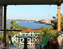
Manly Boat Harbour

With school holidays coming up, it’s always a good idea to have a few interesting walks planned, to get rid of all of that excess energy!

 
One of our favourites is the foreshore walk between Wynnum and Manly. It’s about 4.5km one way with a smooth path suitable for strollers and scooters. There are plenty of playgrounds on the way along with picnic shelters.

At the Wynnum end, the shady playground near the Wynnum Jetty is great for kids of all ages and there are cafes and takeaways opposite. It might still be a bit chilly, but the Wynnum wading pool is a great places to cool down if we get one of those hot mid-spring days.

Manly Playground

The Manly end of the walk has a public swimming pool, a big playground with picnic shelters and plenty of cafes along Cambridge Parade. There are also markets on Sundays. Children will enjoy a stroll out onto the William Gunn Jetty to see people trying their luck with a fishing line, and yachts coming and going from the marina. The cafe on the jetty has great views of the action.

Do you have any favourite walks for kids in Brisbane?

Gateway Bridge Walking Path

I received a question from keen Brisbane walker, Alayne, who asked about access to the walking path over the new Gateway Bridge (officially named the Sir Leo Hielscher Bridge).

Alayne, access from the south side of the bridge is from Lytton Road.  There is space for parking on the shoulder of Lytton Road on the east side of the bridge. At the moment, it looks like a bit of a construction site with the Lytton Road off ramp still being finished.  However, don’t be put off by the construction because there is pedestrian access beside the barriers. 

On the north side, parking is on Lavarack Avenue with access to the pedestrian path between Harvey Street North and French Street.

Late in 2010, new parkland with car parking, will open up under the south side of the bridge, and this will link up with the pedestrian pathway over the bridge. So this will be the best place to start a walk over the new Gateway Bridge. I’ll write up a walk description and map once it’s all completed.

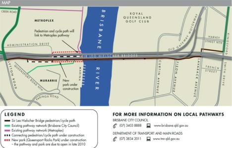
In the meantime, below is a map which comes from an information sheet produced by the Gateway Upgrade Project information office. You can download a more printer-friendly information sheet with the map (on page 2 of the PDF) from their website.

By the way, the people who work in the Community Relations Team for the bridge upgrade (freecall 1800 700 525) are really friendly and helpful if you have any questions about walking or cycling access.

I’m a bit embarrassed to say that I have yet to walk the full length of the bridge (I only got 200 metres onto the bridge on the crowded open day). I’ve been busy writing my next walking guide book which is for the Sunshine Coast. So if anyone would like to give the bridge a ‘walking review’ please use the comments section or email me: editor (at) brisbanewalks.com.au.

Gateway Bridge Walking Path

Mt Coot-tha Walk

Mt Coot-tha Simpson Falls

Welcome to guest blogger Julie……..  On a cloudy and (dare I say it, coming from Melbourne!) wintry day in Brisbane, am up visiting friends over the school holidays, one of whom is Dianne McLay, the author of Brisbane’s Best Bush, Bay and City Walks.  Di and I have walked together over more years than we care to remember, in many countries and in all sorts of weather.  So a wander around one of her walks with all our kids in tow seemed a good way to burn some energy and warm up. 

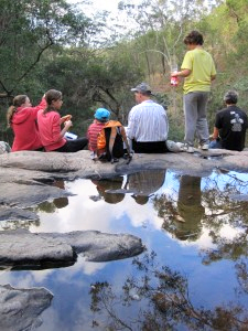
We headed for one of her family’s favourite walks, the Mt Coot-tha – Simpson Falls circuit, which starts from the Grey Gum car park along the main Mt Coot-tha ridge.  This walk has a bit of everything – views, ups and downs along interesting paths, wildflowers, gullies, creeks and a strategically placed rock-strewn waterfall about two-thirds of the way along for a great rest and refreshment stop. 

It’s a wonderful feeling to be so close to the city yet truly feel like you are miles away in the bush.  After a fun, scrambly detour to explore the mostly dry, but beautiful water course below the waterfall, we headed back to the Summit for that panoramic view across the city as the sun was setting.  What a fantastic day!

New Gateway Bridge

Gateway Bridge Open Day

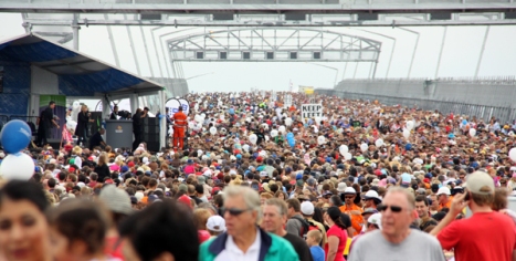
We joined an estimated 170,000 people to create the first traffic jam on the new Gateway Bridge on Sunday 16 May 2010.  We had intended to walk right across, but arrived just as the official opening ceremony started, which resulted in everyone stopping.  We decided to retreat and grab a coffee from one of the market stalls to wait for the foot traffic jam to clear.     

 Alas, after drinking our coffees, and then a plate of yummy Dutch pancakes, the crowd was still at a standstill.  We decided that in years to come, we could say we were amongst the first to walk on the bridge, even if it was only 200 metres of it.     

 But, if you weren’t there for the official opening, you’ll still be able to walk across the bridge, without the foot traffic jams, on the dedicated pedestrian and cycle path way.      

 Once they’ve joined all of the walking paths up on both sides of the river, I’ll write a walk description with distances, points of interest, public transport, parking and photos then post it all on this site. Eventually, it will be written up in Brisbane’s Best Bush, Bay and City Walks when a new edition is printed, but you’ll see it here first.     

 A few facts about the bridge:      
Gateway Bridge construction

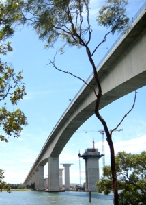
 The first Gateway Bridge, which is mirrored by the new bridge, was opened 24 years ago on 11 January 1986. The bridge had to been constructed to allow shipping traffic underneath, yet be under 80 metres above sea level because of air traffic requirements.   

The Gateway Bridges, both of them, have been officially re-named after Sir Leo Hielscher, a public servant, who noted that he would still have to pay the toll when he crosses the bridges.     

For a live view of the traffic on the bridge, take a look at the webcam images on OurBrisbane.   

The new bridge, which will carry six lanes of southbound traffic, is 27 metres wide and 64.5 metres above river level with its main span being 260 metres long. The pedestrian and cycle way, built on the eastern side, is 4.25 metres wide and has four rest areas.  I’m looking forward to seeing the views over Moreton Bay.  

157,000 tonnes of concrete and 11,600 tonnes of steel were used in its construction and it’s designed to last for 300 years.

Walk from Regatta Hotel to City

I recently re-walked the Toowong (Regatta Hotel) to City route from my book, Brisbane’s Best Bush, Bay and City Walks.  There have been a few changes along the path including two new bridges and improvements to the riverside pathway. 

Walk - Toowong to City

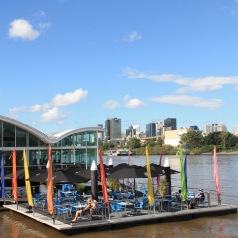
 The first change I noticed was about one kilometre from the Regatta Ferry Terminal.  Oxley’s Restaurant which sits on poles over the water, has added a floating pontoon with tables sheltering under umbrellas.  I sat at a table right near the edge and it felt a little like being on a boat.  On a warm autumn afternoon with cooling river breezes, it’s very pleasant. I had a coffee  ($4) and bread with dips ($4).  If you prefer to travel by water, you can tie your boat or jet ski to the pontoon while you dine. 

Be warned, the pontoon does move, especially after a CityCat river ferry zooms past. The waiter told me that for those who prefer a more stable table, you can sit upstairs in the restaurant where the floor doesn’t move at all. 

The pathway has been upgraded and along the way there are shady shelters and drinking fountains. On one section, separate tracks for pedestrians and cyclists have been marked and it would be much safer if there was enough space for all paths to be like this. 

The Go-Between bridge (named after a popular Brisbane band) will be finished later in 2010 and will carry road traffic as well as cyclist and pedestrians.  

Path under Kurilpa Bridge

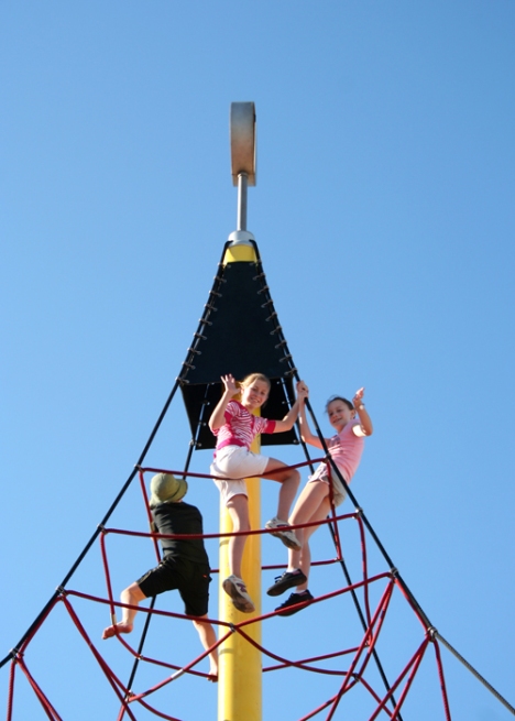
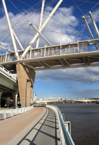
 The Kurilpa Bridge has already received a number of nicknames including the chopsticks, knitting needle and spiderweb bridge. Personally, it reminds me of ships’ masts. More about the Kurilpa Bridge and its solar panels and LED light display in the next blog entry. 

The walk from Toowong to the city is still as beautiful as ever, especially in the late afternoon when golden sunlight reflects off the bridges and city buildings. 

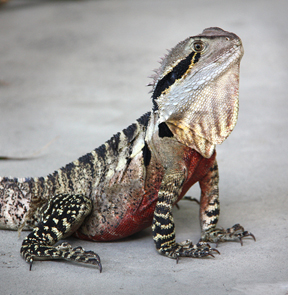
There’s plenty of wildlife to look at and this Eastern Water Dragon (pictured) relaxing in a mangrove tree didn’t seem at all bothered by all of the humans passing by. 

Eastern Water Dragon beside Brisbane River

To do this walk, start at the Regatta Ferry Terminal and follow the riverside path right into the city. After walking under the Kurilpa Bridge and the Riverside Expressway, you’ll reach North Quay Ferry Terminal where you can take a CityCat back to your starting point, or climb up to street level to explore the city. It’s about 3.5 kilometres of easy, flat walking.

Gallery of Modern Art


Eastern Water Dragon - Gallery of Modern Art

After a walk along the river at South Bank, we stopped for a rest at the Gallery of Modern Art (GoMA). We found this Eastern Water Dragon just near the gallery’s River Cafe.  Males have a red belly and we thought he was as beautiful as the art inside. 

If you happen to be taking a walk along the south side of the Brisbane River, GoMA’s current exhibition, the 6th Asia Pacific Triennial of Contemporary Art is a great place for a break (and the air-conditioning is welcome on these hot days).  Admission is free and there’s something to interest everyone. Children are particularly well catered for with lots of hands-on activities. Don’t miss the ‘string room’ which is a unique, walk-through experience. Remember your email address because you can create artworks on touch screens and email them to yourself.

North Stradbroke Island – The Gorge Walk

One of my favourite places for walking is North Stradbroke Island.  Locals refer to the island as “Straddie”.

Gorge Walk - Stradbroke Island

Gorge Walk - Stradbroke Island


While it’s not part of Brisbane (it’s in the Redland’s City Council area), Straddie is close to Brisbane and a favourite with locals for camping, swimming, surfing and fishing.

To get to Straddie, you take a car or passenger ferry from Cleveland across to the small township of Dunwich.  On the far side of the island is Point Lookout, another small township.  Here you’ll find surf beaches, spectacular coastal scenery, accommodation from camp grounds to resorts and places to eat. 

From June until late November, Humpback Whales pass close to Point Lookout.  One of our favourite activities at Point Lookout is to take a picnic lunch and watch for whales (opposite the shops at 19 Mooloomba Rd).  And if you need a post lunch treat, try Oceanic Gelati which has some of the best ice cream I’ve ever tasted.  Apart from whales you might see pods of dolphins surfing the waves below, along with human surfers.

The Gorge Walk

North Gorge Lookout - Stradbroke Island

North Gorge Lookout - Stradbroke Island


This walk starts on the opposite side of the road from the Gelati shop.  The path begins just beside the public toilet block.  There are quite a few steps on this path (but it’s worth it) and small children will have to be closely supervised.

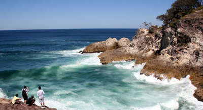
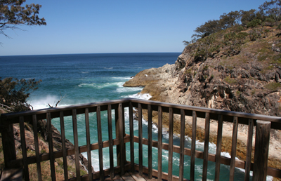
Simply keep the coastline on your left and follow the well-defined track. There are plenty of places to stop and admire the view.  At North Gorge, you can walk out onto the rocks.  This is a great place to sit and look for Stradbroke Island’s Big Five – whales, dolphins, sharks, sea turtles and manta rays.

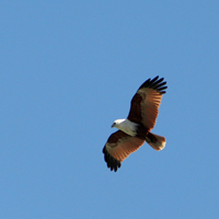
Brahminy Kite

Brahminy Kite

On the opposite side of the Gorge you may hear Whale Rock Blowhole.

The path follows the contour of North Gorge.  After rounding Point Lookout, you’ll see South Gorge and views beyond of Main Beach.

Look out for Brahminy Kites, hunting in the skies above.  These birds have a white head and chest with brown wings. Follow the path to the road, turn right and after a short time, you’ll be back at your starting point.

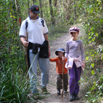
Brisbane Bushwalks for Kids

Brisbane Bushwalking

Brisbane Bushwalking

If you’re looking for walking tracks in Brisbane suitable for children, take a look at my article on the Ourbrisbane website.

Each walk has a ‘reward’ at the end – either a playground or nature centre with animals.

South Bank – Cool Pools

If you’ve been walking in the South Bank Parklands, you would have seen the huge lagoon swimming pools and Australia’s only inner-city beach.  These are free and open to the public.  In summer, they’re one of Brisbane’s favourite spots to cool down. Children especially love the “Aquativity” water play area which opens 7am – 7pm.

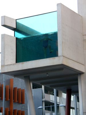
Mantra Pool

Mantra Pool

There’s a much smaller pool in Grey Street that kids always love to see.  It hangs over the edge of the first floor at the Mantra Hotel in Grey Street (corner of Glenelg St – stand in front of Rydges Hotel for the best view).  If you’re there at the right time, someone might be swimming and you can see them through the glass end of the pool.  

We’ve stayed at the Mantra as a special treat, and my daughter had a great time waving at people in the street through the pool’s glass.

Newstead House

It looks like this weekend is going to be a great one for walking in Brisbane – fine and around 24 degrees. 

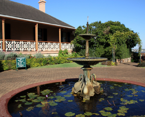
Newstead House

Newstead House

If you’re looking for a pleasant Sunday afternoon post-walking activity in Brisbane I can highly recommend Newstead House.  It’s Brisbane’s oldest surviving residence and from it’s wide verandas, there are views of the Brisbane River and Breakfast Creek. 

A tour through the house gives you an idea of what life might have been like for the wealthy when Queensland was a new colony.  The enthusiastic volunteer guides bring the history of the house to life with lots of interesting stories.

Newstead House Veranda

Newstead House Veranda

On Sundays from 2pm to 4:30pm, Devonshire Tea (with real China cups) is served on the veranda. 

The residence sits in Newstead Park which, with its Brisbane River views and shady trees, make it a great picnic spot.  You can also take a stroll along the riverside path, past more modern riverside homes.

Location: Corner Breakfast Creek Road & Newstead Avenue, Newstead
Entry to Newstead House:  $4 adult, $3 concession, $2 child, $10 (2 + school aged children), free admission first Friday every month
Opens: 10am – 4pm Mon – Fri, 2pm – 5pm Sun